Keyword: Cartography 5

×

Land Lines / Zach Lieberman, Matt Felsen
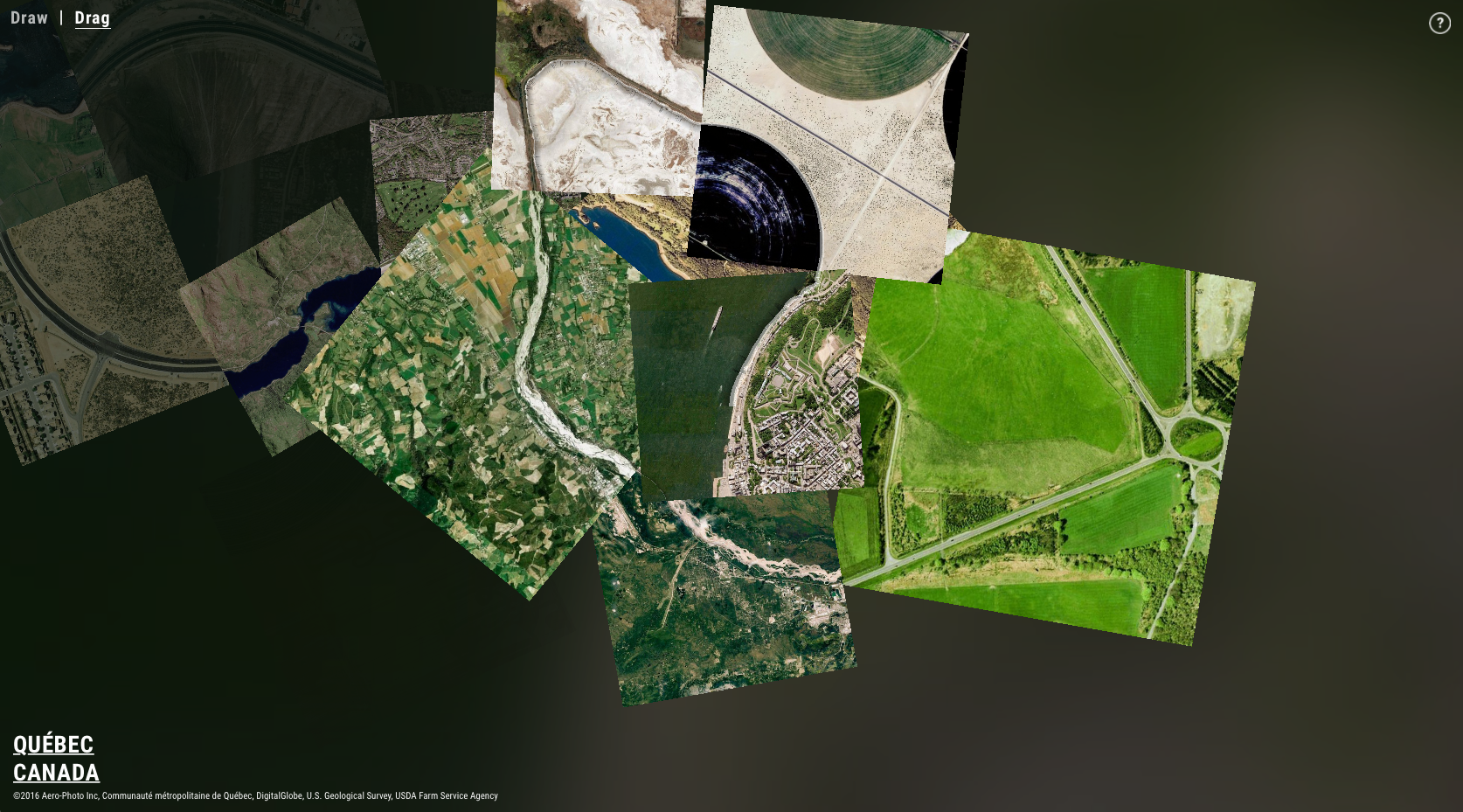
Land Lines is an experiment that lets you explore Google Earth satellite imagery through gesture. “Draw” to find satellite images that match your every line; “Drag” to create an infinite line of connected rivers, highways and coastlines.”

https://lines.chromeexperiments.com

Uncharted Atlas / Martin O’Leary

A twitter-bot auto-generating imaginary maps.

http://twitter.com/unchartedatlas
Website

The True Size Of …

http://thetruesize.com/

Myriahedral Projections

“A myriahedron is a polyhedron with a very large number of faces. For this reason, we call the results myriahedral projections. In step 2 and 3, this myriahedron is cut open and unfolded. The resulting maps have a large number of interrupts, but are (almost) conformal and conserve areas.”

http://www.win.tue.nl/

Nuancen der Unwahrheit / Tina Michl

Graduation project about cartographic projection methods.

http://www.fbg.h-da.de/projekte/